Product Description
SmartNet is a 24/7, accurate, reliable and robust National GNSS Network solution, based on a common datum, for the entire positioning community of Great Britain. Users of SmartNet can expect centimetre level Network RTK accuracies, through to sub-metre DGPS and raw "SmartRinex" data for post processing.

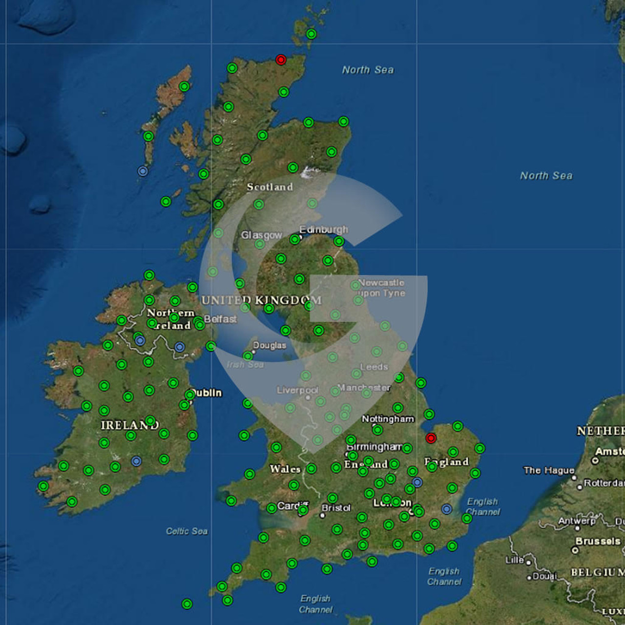
SmartNet is the first commercial GNSS (Global Navigation Satellite System) Network based on raw data from the Ordnance Survey GNSS networks in both Great Britain & Ireland. This network comprises approx. 150 sites, including additional sites from Leica Geosystems permanent nationally deployed GPS reference stations.
A Network RTK solution combines observation data at base-stations and at the Rover to generate RTK corrections for the Rover's location. A user subscribes to the service by dialling in through the internet, in order to receive RTK corrections to their Rover. These RTK corrections can be generated by more than one method; Master-Auxiliary corrections (MAX), Individualised MAX (i-MAX) and Virtual Reference Station (VRS).
The key advantages of using SmartNet are:

- No substantial purchase costs of a GNSS base station
- No time lost establishing a local reference receiver
- No security concerns at the reference station site
- SmartNet is available nationwide
- Guaranteed quality assurance and traceability
- Free of charge SmartRINEX download facility for post processing
Precision to the centimetre
Precision GNSS positioning gives you location accuracy down to the centimetre. The exact precision, reliability and predictability you need for surveying and asset mapping, machine control and automation.
The largest and most reliable global service
HxGN SmartNet has more reference stations around the world than any other GNSS correction service provider. That means incredible accuracy and reliable coverage for your business.
For users with multi-constellation GNSS receivers able to track Galileo and BeiDou satellites as well as GPS and Glonass, HxGN SmartNet can provide corrections from all available constellations.
GNSS and the contributions of CORS networks is a well established technology for all land surveying applications. HxGN SmartNet's precision and reliability further connects surveying for increased productivity.
Services
HxGN SmartNet can be used in a variety of land surveying applications that require centimetre accuracy, such as building and topographic survey, monitoring and cadastre applications.
How it works
With access to HxGN SmartNet, you simply set up your GNSS rover and away you go. No need to worry about finding a secure site or forgetting cables. You are also not limited by radio range or interference issues. To top it off, you do not need to have your own RTK base station, almost halving your capital investment.


