Product Description
REALITY CAPTURE FOR ALL
The BLK360 G1 is a compact imaging laser scanner that uses a 360° laser distance meter and high definition panoramic imaging to create a 3D point cloud of the space around it.
The Leica BLK360 G1 captures the world around you with full-colour panoramic images overlaid on a high-accuracy point cloud. Simple to use with the single push of one button, the BLK360 G1 is the second smallest and lightest imaging laser scanner of its kind. Anyone who can operate an iPad can now capture the world around them with high resolution 3D panoramic images.
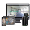
Using Leica Cyclone FIELD 360 mobile-device app, the BLK360 G1 streams image and point cloud data to an iPad or final project data to Cyclone REGISTER 360 or Cyclone REGISTER 360 (BLK Edition) via Wi-Fi. With automated workflows in both software offerings, the BLK360 plus the software solution of your choice, dramatically streamlines the reality capture process thereby opening this technology to non-surveying individuals. Simple export of LGS or RCP files makes working with point cloud data downstream in the Leica Geosystems and Autodesk suites simple and efficient, allowing users to spend less time processing data and more time creating meaningful deliverables.
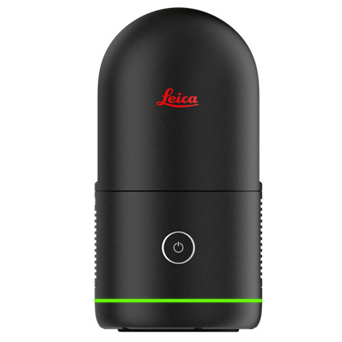
BLK360 G1 imaging laser scanner
- Allows you to scan in high, standard and fast resolutions
- Weighs 1 kg / Size 165 mm tall x 100 mm diameter
- Less than 3 minutes for full-dome scan (in standard resolution) and 150 MP spherical image generation
- 360,000 laser scan setpoints per second
- High-Dynamic Range (HDR) and thermal imaging
Software offerings to meet your needs
- Upgrade your subscription to Cyclone REGISTER 360 for users who want to take on mid-to-large scale projects involving additional data sources
- Bundled with Leica Geosystems’ next generation of registration software, Cyclone REGISTER 360 for users who want to take on mid-to-large scale projects
- Operate the BLK360 to automatically capture, register and examine scan and image data, directly within the Cyclone FIELD 360 app from any iOS or Android mobile-device
- Directly publish your captured data from Cyclone FIELD 360 to Leica TruView Cloud to quickly exchange project information prior to import and registration
SPEED
On-the-fly image and point cloud processing in the field and auto-registration office workflows with Cyclone REGISTER 360 and Cyclone REGISTER 360 (BLK Edition).
SIMPLE
One-button automatic operation. Small enough to take anywhere. Rechargeable lithium ion battery with secure WiFi data transfer. Completes a scan within minutes.
POWERFUL
LiDAR technology that captures 360,000 points per second. Three spherical, panoramic HDR cameras with a thermal imaging camera. Delivers 3D point clouds with millimeter accuracy.
RELIABLE
Create an accurate digital twin of your site with laser-based measurements.
PORTABILITY
Flexibility to scan wherever, whenever with the small, lightweight imaging laser scanner that fits into a messenger bag.
EASE-OF-USE
Push-button scanning that automatically stitches and registers captured scan data for in-field visualisation in the mobile version of Cyclone FIELD 360, transferring seamlessly to Cyclone REGISTER 360 or Cyclone REGISTER 360 (BLK Edition) via Wi-Fi for final processing.
CLOUD CONNECTIVITY
Better collaboration and virtualisation with cloud sync.
SIMPLIFIED DATA COLLECTION
Two-in-one 360º image documentation and laser scan data.
INTEROPERABILITY
Fully compatible with the Leica Geosystems laser scanning field-to-finished software suite.
VIEW, COMBINE, AND VALIDATE YOUR DATA ON-SITE WITH CYCLONE FIELD 360
Cyclone FIELD 360 is the mobile companion app to REGISTER 360. Available for iOS and Android devices.
VISUALIZE IN 3D
View, inspect and fly through your 3D point clouds.
VIEW SPHERICAL IMAGERY
View 360° imagery from each scan location.
DIMENSIONS AT YOUR FINGERTIPS
Take point-to-point measurements from any two points in your accurate and scaled point clouds.
BLK360 AT WORK
The BLK360 G1 is used across multiple industries including architecture, construction, media and entertainment, historic preservation, and more.
3D MODEL
A BLK360 point cloud is all you need to make an accurate 3D model.
2D FLOORPLAN
Slice the point cloud to create a precise 2D floorplan.
3D MESH
Convert your points clouds into a mesh for photorealistic visualization.
VIRTUAL TOURS
Use BLK360 high-resolution photospheres to create immersive virtual tours. Learn more about remote collaboration with BLK360 and Leica TruView.
Includes
Leica BLK360 G1 Imaging Laser Scanner
Leica BLK360 Transport Hood
Leica GEB212 Lithium-Ion Battery x3
Leica GKL312 Battery Charger
Leica GEV192-9 AC/DC Adapter
Leica Car Adapter for GKL312
Leica BLK360 Quick Guide
Leica BLK USB Documentation Card

Product Videos
Videos Hide Videos Show Videos
-

Meet the BLK360 from Leica
Shop BLK360➟ https://tinyurl.com/y73k79t8 Still haven't subsc...
-

Leica Cyclone FIELD 360 Mobile-Device App – The perfect field companion
The Leica Cyclone FIELD 360 mobile-device app is the perfect f...
-

Leica BLK 360 Example Scans
@g2survey
-

A Tutorial for the Cyclone FIELD 360 App with Andy Fontana
Andy Fontana demonstrates how to use the Cyclone FIELD 360 app...
-

Leica Geosystems presents The Power of Scanning
It’s never an accident; it is always the result of high intent...

